
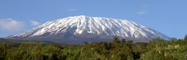
Kilimanjaro
Tuesday, January 31, 2012
Monkey Business
Too Much

Monday, January 30, 2012
Another Flight Photo

Moshi Market

The photo above is of the Moshi Market, where they didn't want us taking photos. They are suspicious that we will sell our photos and make money from images of them. This market was like nothing I have ever seen. Actually, Tanzania is like nothing I have seen before. And I love every bit of it.
But it is sooooo HOT it is insane. We are retreating back to the hotel for some pre-climbing beer and peace. More updates to come.
Arrival in Moshi!

Sunday, January 29, 2012
Yo, Sup Kenya?

After 17 hours of flying we will board a very small propeller plane here in "Nairobbery" which will take us to Kilimanjaro Airport in Tanzania, about an hour's drive from our hotel in Moshi.
This is our first time south of the Equator and we are happy to be landing at night as it is only +25C here right now. I need me a Canada Dry :-)
Habari, Saraha!

Saturday, January 28, 2012
Bonjour Montréal

Friday, January 27, 2012
w00t: Over 100% And Counting!
On the night before we depart for Africa we are VERY HAPPY to announce that we have exceeded our goal. Tonight we received a number of donations that have taken us to over 105% of our goal of $1/metre. To every single person who contributed to this fundraiser for Cancer, you have our most sincere appreciation. The principle behind our fundraiser was to make a contribution to Cancer Research so we hope that hitting this awesome milestone will not dissuade anyone from contributing more. If you want to contribute or have thought about it, PLEASE DO. It all helps. We would welcome your generosity and we believe that it WILL make a difference to someone somewhere in some small way, shape or form. And again, to all those who have kicked in a few hard earned bucks, thank you very, very much!!!
Climb on!
All Our Bags Are Packed...

Hamish flew out of Calgary last night so he is still in the air now. I have not seen him in a dozen years so it will be quite a reunion when Scott and I arrive in Moshi on Sunday night.
So far everything is coming together nicely and we are so close to hitting our fundraising goal for cancer research. Just a small amount to go! Have you donated yet??
Above is a screen shot of the weather forecast for Moshi, Tanzania. It looks pretty good to us Canadians :-)
Of course, we will be leaving these warm temperatures to climb upwards to the glaciers, but that is just because we have several screws loose. Ongoing updates will follow.....
Thursday, January 26, 2012
Kili4Cancer Apparel :-)

We're off!
Well, Jamie is off. "A journey of a thousand miles begins with a single step". In my case that step is the shuttle from Canmore to the Calgary Airport. I would say I have butterflies but it's really nausea from the anti malarial. In less than 24 hours I'll be tucked in my mosquito net at the Keys Hotel in Moshi near the base of Kilimanjaro. Yeehaw!
Jamie McVicar
jamiemcvicar@shaw.ca
(403) 688-0988
Tuesday, January 24, 2012
Live Updates Of Climb
Thanks to a colleague and all around great guy who lent me his iPhone 4S, we should be able to post Live Updates online as we ascend the Mt. Kilimanjaro each day. Of course, there are many factors that have to come together for this to happen, but thanks to Aziz we should be able to post photos and text feeds right to our Blog Site at kili4cancer.blogspot.com. Thanks Aziz!!
So Bookmark us, add us to your Favorites, add your email address below on the right to receive automatic updates or just tune in. We'll have some fun with this....
Monday, January 23, 2012
Are You A Mzungu?
Well, are you? I know I am!
Wikipedia described a Mzungu as a Foreigner who "walks around aimlessly". Wow, that's Bang-On! How'd they know?
Here's the jump: http://en.wikipedia.org/wiki/Mzungu
Sunday, January 22, 2012
Part C: The Climb


This is the third of a 3-Part Series of articles where we describe some of the details of our Climb of Mt. Kilimanjaro. In Part A we covered the Gear we’re taking. In Part B we reviewed the Trip Logistics. In this segment we explain the Climbing Route, what we will encounter over this week-long adventure, and why Kilimanjaro is such a truly unique place.
****************
Have you ever thought of climbing Mount Kilimanjaro? The mountain has one of the most unique climatic environments on the planet and it is situated in one of the most compelling countries anywhere. During a six-day ascent of this über-volcano, climbers are privileged to walk through six distinct Climate Zones, each with unique plants, animals and ecosystems. There are also unique challenges at each stage of the journey. Here is an example of what we will see and do in less than one week on our ascent of the mountain, and the route that we have chosen, the Machame Route:
Day 1 (Jan31): Machame Gate (1634 m/5,363 ft) to Machame Hut (2834 m/9,300 ft).
Hike time: 8 hrs
Elevation change: +1200 m/+3937 ft
Estimated distance: 10km/6.21 miles
Final elevation: 3100 m/10,170 ft
We leave the town of Moshi, Tanzania and head to “Machame Gate” in Kilimanjaro National Park which is where the fun starts. It is illegal to enter the park without having hired a Guide and Porters. We will meet our Head Guide and our High Altitude Porters will start sorting through group’s gear. As Climbers, we will each take a daypack with 3 litres of water, our lunch, rainwear and some extra warm clothes for higher up. The Porters will take a week’s worth of food and cooking equipment for the team, all the tents and sleeping bags and communal gear in addition to their own gear. Similar to Napalese Sherpas, it is remarkable to see these guys carry 30lbs on their heads and they scamper like gazelles up the mountain. But this is what they do all day, every day.
From Machame Gate we hike for about 8 hours on well marked trails to our first camp. The first part of this day, we’ll be in the “Culitvation Zone” (2,600-5,900’) were we will have tropical conditions. An average of 45 inches of rain falls there each year. These lowlands are densely cultivated with coffee and banana plantations as we start walking. Soon we’ll enter the Rain Forest at around 5,900’. This zone receives the highest amount of rainfall, up to 78 inches per year! The moisture results in a belt of dense rain forest and mist. Brightly colored butterflies, toucans, and colobus monkeys can be found here. The average temperature should be around +25C so we’ll be hot and humid as we carry our packs. Rain jackets are a must and everything in our packs and duffle bags will be in water-tight bags. Sadly, due to the rain and cloud, we likely won’t see the forest for the trees (Hahaha!).
Day 2 (Feb1): Machame Hut (2834 m/9,300 ft) to Shira Hut (3749 m/12,300 ft)
Hike time: 7 hrs
Elevation change: +800 m/+244 ft
Estimated distance: 6km/3.75 miles
Final elevation: 3800 m/12,467 ft
After a 6AM start, we’ll be in the Health Zone at 9,200’, which is covered with heather and bright flowers. I’ll be snapping bus loads of photos here. Above the heath is a black Moorland where plants such as Lobelias and Gigantic 30’ Groundsels look like something from Jurassic Park. With no real trees, there are only a few Critters left in this zone. Winds will be noticeably higher so we will need to layer up with some jackets. It should be about +10C at this stage and we will likely still be in heavy cloud.
Day 3 (Feb2): Shira Hut (3749 m/12,300 ft) to Barranco Hut (3901 m/12,800 ft)
Hike time: 6 hrs
Elevation change: +100 m/+328 ft
Estimated distance: 6km/3.75 miles
Final elevation: 3900 m/12,800 ft
Here is where we start to feel life we brought a piece of Canada to Africa! We’ll be in the Alpine Desert zone from 13,100-16,400’. Harsh conditions prevail here. This zone is typically above the clouds so this semi-desert region receives less than 10 inches of rain annually. Temperatures here are normally around or below freezing and chilly at night. High winds are relentless and the fine dust permeates everything you have no matter how well you cover it up. This includes the hose of the hydration systems that we will carry (Platypus). Few plans can survive here, mostly just moss and lichen. Many describe this as a lunar landscape with strange volcanic forms everywhere. It will become noticeably harder to breath at this elevation so we will follow the Climber’s Mantra of “Climb High, Sleep Low”. On this day we will gain a bunch of elevation as we climb up to Lava Tower, a huge, remarkable volcanic rock formation, and then descend pretty much the same distance to camp low at Barranco Camp.
Day 4 (Feb3): Barranco Hut (3900 m/12,800 ft) to Karanga Valley (3963 m/13,000 ft)
Hike time: 4 hrs
Elevation change: +100 m/+328 ft
Estimated distance: 4km/2.5 miles
Final elevation: 3963 m/13,000 ft
As we will spend a few days traversing from the West to the East part of the mountain we will be gaining and losing elevation so that our bodies start producing more Red Blood Cells which will carry the lower amounts of oxygen to the muscles that we’ll need to carrying us upward, step by step, hour after hour, day after day. This is one of the reasons we picked this route as it is difficult but ideal for Acclimatization. Right after breakfast on Day 4 we will have to climb the dreaded Barranco Wall - a huge rock precipice that we will need hand and footholds to ascend. This is the steepest part of the trip, similar to a relatively easy grade of Rock Climbing, but without the ropes. We’ll need to be very careful here as the Barranco Wall is about 10 stories tall, and we will be working with less oxygen which will make it seem tougher. After the Wall, we will again descend to a lower elevation at our next camp which is relatively protected in a cool little valley.
Day 5 (Feb4): Karanga Valley (3963 m/13,000 ft) to Barafu Hut (4,600 m/15,091 ft)
Hike time: 4 hrs
Elevation change: +600 m/+1968 ft
Estimated distance: 4km/2.5 miles
Final elevation: 4,600 m/15,091 ft
Another relatively short day of ascending into the Alpine Desert Zone, and another day of high winds and cold temperatures in a moon-line landscape. This day will bring us all the way over to the east side of the mountain and up to our High Camp (Barafu). We will need to sleep during the afternoon in anticipation of a midnight departure for the top.
Day 6 (Feb5): Barafu Camp (4,600m/15,091 ft) to the Summit (5896 m/19,343 ft) and then back down to Mweka Camp (3100 m/10,170 ft)
Ascent time: 8+ hrs
Elevation change: +1300 m/+4265 ft
Estimated distance: 5km/3.2 miles
Final elevation: 5896 m/19343 ft
Descent time: 5-7 hrs
Elevation change: -2800 m/-9186 ft
Estimated distance: 12km/7.5 miles
Final elevation: 3100 m, 10,170 ft
We plan on making an “Alpine Start” at Midnight, which means that we will be climbing about 6 hours by the light of our headlamps. Fortunately we planned this trip to coincide with a full moon, which should be Epic! This will be a looong, and hopefully rewarding day in the Arctic Alpine Zone, above 16,400’. It’s an icy wasteland, baked by fierce sunshine during the day and frozen at night (Good!!). The weak air pressure here means that our lungs need to work twice as hard to get the oxygen they need to keep our bodies working (Woohoo!). Most climbers report serious headaches at this altitude (Bring it). Sleeping, eating and drinking become very difficult and our energy will be sapped (I Love it!). We’ll all need to borrow from Scott’s Iron Will here! This is also where the glaciers are so it will be very, very cold: -15C at best. We plan on wearing all layers of our clothes here, including two pairs of mits, down coats and balaclavas.
After all that exhausting work getting up, we should have just enough energy to snap some photos and drink in the view from the Roof Of Africa as the sun rises over the Indian Ocean and treks across the great Serengeti to Lake Victoria and beyond. But we can’t relax, because we need to get down from this altitude soon. The descent will be quick as we can “ski” through all the loose shale that we trudged up earlier, making our way back to our high camp for some food and water before descending even further on a different trail system called the Mwenka Trail. This is a steep trail that is only used for descending so as long as we have some gas left in the tank we should arrive at our last camp around dusk. This will make for a very long, hard day.
Day 7 (Feb6): Mweka Hut (3100 m/10,170 ft) to Mweka Gate (1828 m/6,000 ft)
Descent time: 4 hrs
Elevation change: -1250 m/-4101 ft
Estimated distance: 10km/6.21
Final elevation: 1828 m/6000 ft
I read somewhere that this is the most beautiful part of the trip. The Rain Forest is spectacular, the vegetation is beautiful and the views over the African Plains are surreal. I fully expect, however, that this point of our trip we will have mixed feelings: We’ll likely be relieved that all the exertion and knee-jarring punishment is nearly over, but also wishing that this wild, exotic adventure was not yet over. By the time we arrive at Mwenka Gate we should be thoroughly spent, welcoming the Land Rovers that will return us to Keys Hotel in Moshi, some clean clothes and lots of cold beer.
Hopefully this puts things into perspective, particularly for the many people who have been asking us about what things will be like. We just may get back after this trip and realize that we were way off on some of these key points, or we may end up returning after having made it no higher than the first camp - time will tell. One thing is for sure, with less than a week to go until the plane’s wheels touch down on a Tanzanian soil, we already having an amazing time researching, training, getting kitted up and meeting so many awesome people who are willing to help us with guidance and donations for cancer.
Which reminds me, if you have not donated, please take a moment to do so. Even just a couple of dollars will help. If you can’t donate, please help us spread the word. We are only a few days away from leaving and we are so very, very close to realizing our fundraising goal. Join us in our efforts to Do Something Big!
Asante sana!
Terry
Saturday, January 21, 2012
What Time Is It?
If you travel to East Africa, expect to find some confusion about what time it is. Tanzanians use a different Clock than we do!
"Swahili Time" is based on a clock that is six hours behind ours. Ironically, this was done to simplify the process of telling time (lol). See, Tanzania is just south of the Equator, so the sun rises at 6AM and sets at 6PM every day of the year. In "Swahili Time", dawn coincides with 12 O'Clock (6:00AM to the rest of the world) and dusk is the same, 12 O'Clock (6:00PM to people like us). In "Swahili Time" locals count upwards from Dawn to Dusk. Simple, right?
Swahili Time is unofficial, sort of. Governments and Schools measure time in the manner that you and I know, but almost every Tanzanian is familiar with "Swahili Time" and some use it to organize their lives.
This is particularly important to keep in mind if you travel to Tanzania. For example, if you call for a taxi and tell them that you need it at your hotel for "8 O'Clock" so you can get to the Airport to make a "10 O'Clock flight", your Taxi might show up at 2:00PM, which is "Swahili Time" for "8 O'Clock", but a full six hours before you expected them! I hope you packed last night!
So remember, 6:00AM is 12 O'Clock, Noon is 6 O'Clock and 6:00PM is the *other* 12 O'Clock. Is that clear?
Wednesday, January 18, 2012
African Fun Fact #94
Did you know that a Giraffe can clean it's ears with it's *21 inch tongue*? Ya, true stuff!
Tuesday, January 17, 2012
Monday, January 16, 2012
11 Days & $1100 Left
I can't begin to relate how amazed I am with the spectacular donations that we have received just over the last few days. Without taking anything away from those who donated previously, I just want to point out that in the last three days our Donations Graph has climbed from 56% to 82%. This is really remarkable and humbling. To everyone who has donated so far in this campaign, I thank you very, very sincerely.
We're not done yet though. With just 11 days left until our plane leaves for Africa, we have less than $1,100 to go to reach our goal of $1 per Metre (5,895m) to be climbed. If you think about it, if we climb to a point on the mountain that is 1,100m below the summit, we will still have accomplished something wonderful, but we will have missed our goal. We are prepared to go as high as possible on Kilimanjaro, but we also hope to see our fundraising goal met. Please forward our website address to your friends and help us get the word out. Let's close the gap and Do Something Big!!
Saturday, January 14, 2012
Newspaper Story about our Climb
Imagine waking up in the morning, picking up the newspaper and seeing your face smiling back at you! That is what just happened to me. The Ottawa Citizen has run a very well written article in today's paper (Jan 14, 2012) about our Kilimanjaro Climb For Cancer, including photos from two friends who have both climbed the mountain previously. Check out the story BY CLICKING HERE
Friday, January 13, 2012
Words Of Wisdom for Friday the 13th
 Forecast for Ottawa tomorrow: -20C Forecast for Ottawa tomorrow: -20CForecast for Moshi tomorrow: +30C Airfare to Moshi: Pricele$$ |
Wednesday, January 11, 2012
Words of Wisdom
"The Leader Must Never Fall" - Old School Climbing Philosophy, when braided hemp ropes were used (pre-1955).
Monday, January 9, 2012
PART B: TRIP LOGISTICS


Planning to climb a mountain on another continent is an adventure on it's own. In this segment, the second of our three-part pre-climb coverage, we'll highlight some of the planning that went into Kili4Cancer, 2012.
Flights
Mt. Kilimanjaro is located in the northern part of Tanzania, near the international border with Kenya. The closest town to Kili is Moshi, which serves as the logistical base for many climbing teams. But getting to Mt. Kilimanjaro requires some planning. Many people are inclined to book a flight to Dar es Saalam, the economic hub of Tanzania, or through Nairobi, Kenya. Both options require a long bus ride to Moshi, adding time to a trip where days are a precious commodity. The best option, as we discovered, is to fly to Kilimanjaro International Airport, about one hour southwest of Moshi. This airport, however, is only served by a handful of Airlines, including Air France, Ethiopian Air, Air Kenya and KLM. Air France was ridiculously expensive, so they were not an option. Wanting to save money, we looked at the two African airlines, but we were scared off by the short layovers, such as 45 minutes to change plans in Addis Abbabi, Ethiopia, crossing our fingers that our climbing gear would make it to Tanzania. The best option for us turned out to be KLM and we will keep you posted about how that turns out. Our route to Tanzania takes us from Montreal (no direct flight from Ottawa) to Amsterdam, then to Nairobi and then onto a small propeller plane for the 1 hour flight into Kilimanjaro International Airport. Layovers are sufficient, but not excessive with the exception of our flights back home on February 11 where we have to endure an 8 hour layover in Amsterdam and another 8 hour layover in Toronto before flying into Montreal at midnight. That will be brutal!
Guides and Porters
Tanzania is among the poorest countries in the world, so Tanzanian rules are such that you cannot climb Kilimanjaro without hiring a Guide and High Altitude Porters. Tanzania depends on this foreign interest to create jobs. Unfortunately, some Guiding Services do not treat their Porters well in that many of them do not get paid adequately and many of them climb through heavy rains, wind, snow and cold with inadequate gear. For this reason, some people will book their climb through North American Agencies that specialize in Adventure Travel, thereby having most of the climb logistics pre-arranged. We wanted a less pre-packaged experience, one where the adventure included making our own arrangements with a local Guiding Group that was locally based in Africa. For our trip, we looked to the Kilimanjaro Porters Assistance Project (KPAP), who’s mandate is to improve the conditions for these key people (www.kiliporters.org). We developed our own selection criteria that were aligned with KPAP. We contacted Guiding/Porter services that adpoted the KPAP standards, and were based in Tanzania. We solicited their proposals based on our criteria of our preferred route and number of climbers, and based our Short List on their treatment of Porters, price, professionalism and communication. Eventualy we narrowed it down to one group, Keys Tours, who own their own Hotel in Moshi, the Keys Hotel.
Accommodations
As indicated above, selecting Keys Tours as our Guides meant that we also had a base in Moshi for before and after the climb up the volcano, that being at the Keys Hotel in Moshi. The Keys Hotel is not a 5 Star Hotel. In fact, it is described by others online as being more like a Hostel than a Hotel. That suites us fine. Rather than stay in the main hotel building, we have opted to stay in the African Cabana rooms, round, stand alone rooms with thatched grass roofs. It should be fun. The hotel also has a small pool which should be refreshing apres-climb as the average temperature in Moshi in February is +31C.
All of our accommodations while climbing will be in 2-man, 4-season tents. The tents are supplied by our Guides. There is one route on Kilimanjaro that allows climbers to stay in huts, but this is not the style of trip that we are after. Our goal is to live it all, good and bad. Temperatures will range from +20C as we start climbing to 0C mid-mountain, and -15C up top.
Following our climb we have booked a two-day Safari in Lake Manyara and the Ngorongoro Crater, and area with the highest density of lions and large game than any area of Africa. This should be great. Our accommodation will be the Ngorongoro Lodge, perched on the rim of the massive crater that makes up this Safari Park. This is our one night of luxury and we hope to take full advantage of it (including every piece of food that we can steal from the buffet table!).
Regional Details
Moshi is a great town in northern Tanzania, a country that is just celebrating 50 years of independence from European rule. Although Tanzania is one of the poorest countries in the World, Moshi is relatively well-off thanks to the education that early Missionaries provided to the local Chagga tribe’s people. Moshi is a climber’s town, hosting a steady stream of teams from all over the world, adding to it’s cosmopolitan charm. The most lively part of town would be the open air Market and the coffee shops. Aside from Western Climbers, called Muzungu in the local Swahili language, nothing moves quickly in Moshi.
Northern Tanzania has a great deal to offer, including the Great Migration of millions of Wildebeest and Zebra, making their way from Kenya to the Serengeti Plains of Tanzania each year as they search for food and water. Of course, the other famous African animals are here in abundance (Lions, Elephants, Giraffe, Hippos, etc), particularly in the Ngorongoro Crater, a World Heritage Site and an area that contains the highest density of these animals in all of Africa. Other great Wildlife Parks in the region include Lake Manyara and Arusha National Park.
Aside from Animals, the local people are amazing to discover, such as the Maasai Tribes. Maasai are Semi-Nomadic Herders who have rich African Traditions in their dress, dance and language. More details of the Maasai are contained elsewhere in our ongoing Blog.
Co$t:
The overall cost of this adventure comes in at about $4,500 each, paid from our own pockets. Flights run $1,500, Guiding costs are about $1,500, we added a two-day Safari for $500, a day with the Maasai for $200 plus food, transfers and some gear. Of course, we will need to buy some nice jewellery and souvenirs for our Spouses to pay them back for allowing us to take off for two weeks while they stay home and shovel the driveways! Bribery can be tough ;-)
We hope you enjoyed this second part of our three-part series on our upcoming trip to East Africa. Stay tuned for a detailed description of what is entailed in our climb, and in the meantime, please donate to Cancer Research with the DONATE Button on our website, kili4cancer.blogspot.com
Thanks and Happy New Year!
Saturday, January 7, 2012
Day On Ice

Friday, January 6, 2012
Maasai Village Visit

Shortly after the big volcano climb, Scott, Hamish and Terry have arranged to spend a day at a local Maasai Village in northern Tanzania near the border with Kenya.
The Maasai Tribe are remarkable people who have held onto their nomadic herding practices and deep cultural roots for hundreds of years. Maasai are tall, proud people, typically residing in round, dried dung wall huts topped with thatches. The women manage the village while the men herd and hunt. Many of these men become legendary "Maasai Warriors" in their mid-teens. Maasai Warriors are so skillful and strong that they are the only living creatures that African Lions instinctively run from! The Maasai's colorful robes and gorgeous jewelry are both striking and unique. Their singing, dancing and jumping skills are truly remarkable.
All members of the Kili4Cancer Climbing Team are looking forward to the culture shock when they meet the Maasai people for the first time. Scott is hoping to have his bottom lip pierced with a large wooden plate and Hamish just wants to learn how to jump.
Tuesday, January 3, 2012
Sacred Summit
Kilimanjaro was sacred to the local Chagga people who have had many myths about the mountain. People would build their homes and shops on the side of their land closest to Kilimanjaro and would sleep with their heads toward the summit. The higher up the mountain you live, the more fully human and blessed you are (from Sacred Mountains of the World by Edwin Bernbaum).
My Lesson For Today
This was my lesson for today: Habiri ya Asabuhi. It means Good Morning in Swahili.
Monday, January 2, 2012
A Sign Of Things To Come?
What? Has the famous sign on the summit of Mt. Kilimanjaro been replaced? This Dec30, 2011 summit photo suggests so.
Sunday, January 1, 2012
Last Minute Training
 Trying to squeeze in some back-to-back hikes here in Canmore as we count down to our departure. Up on Ha Ling, Lady Macdonald and Sulphur over the last three days of 2011; 38 kilometres and 2600 meters of vertical. Gotta get these boots broken in!
PART A: THE GEAR LIST

In a three-part series of articles, we will detail some of the logistics that have gone into this expedition to Mt. Kilimanjaro. First, we will detail the Gear that we are packing (see below). Second, we'll talk about the Trip Logistics, including Flight, Accommodations, Regional Details, Mountain Guides and Porter details. Third, we will describe the route that we will be taking up the mountain on this seven-day climb. Join us and enjoy …
PART A: THE GEAR LIST
Many people have asked us about the gear that we would pack for our Kilimanjaro climb, partly because we will be in tents for the 7 day expedition in temperatures that will range from +30C to -15C, but also because of the extreme high altitude. Here is a photo of my gear and a description of most of the items I'm taking with me.
PACKS
- North Face Expedition Duffle Bag with Shoulder Straps, XL/150 litres. Yellow for easy spotting in the many airport carousels we will search. This needs to be rainproof as it will not fit inside our tents.
- MEC Alpine Crag Day-Pack, 35 litres, plus MEC Rain Cover.
- Various small O.R. waterproof compression stuff-sacks for down coats, sleeping bags, food & clothes.
SLEEP SYSTEM
- Sleeping Bag: North Face -18C Down, plus an MEC Emperor Penguin Over-bag
- Sleeping Mat: Big Agnes insulated air-core inflatable sleeping mattress
- Pillow: I normally don't take one but I am old now so my daughter is lending me her Miss Ladybug Cushion. Sweet dreams!
- Ear Plugs so I don't have to listen to Scott snore.
- Alarm on my Casio Altitude Watch for that Midnight start on the last day for the summit push.
OTHER GEAR
- Nikon Binoculars to see Zebras, Elephants, Lions & Giraffes.
- Sunglasses: Smith Trace Polarized Sunglasses with grey/yellow/clear interchangeable lenses and protective case.
- Ski Sticks: Gabel Mount Blanc colapse-able hiking poles
- MEC Thermometer so we know JUST how cold we are :-(
- Casio Watch with Time, Alarm, Altitude & Barometric Pressure gauges
- Accessory cord & accessory carabiners to make a clothes line to hang-dry stuff
- 2x Headlamps and small flashlight for the tent.
HYDRATION & FOOD
- Platapus 3 litre Hydration System mounted in Day Pack with the sucking hose clipped on the shoulder strap of my Day Pack. It is expected that this will freeze at high altitude (above 14,000'), so I will also carry….
- Nalgene Bottle, 1 Litre wide mouth lexan water bottle with an O.R. Insulated Bottle Wrap, carried either in my pack or, if it is too cold, in my jacket to prevent freezing.
- Thermos: MSR lightweight 750ml Thermos with O.R. Insulated Wrap
- Clif Bars, Beef Jerky & Trail Mix for on-the-go energy
- Chocolate: Toblerone & Ritter Bars to keep me happy :-)
- Nuun electrolyte enhanced drink tablets, tropical fruit flavoured
- Starbucks VIA Readybrew dark roast coffee
- A wee bit of Single-Malt Scotch
- Pee Bottle. Climbers are often too embarrassed to mention this but it is important with all the water we have to drink and with the cold temps up high. Don't worry, it is well labelled so we don't confuse it with a water bottle (ew).
CLOTHING
- Head Gear: Ball Cap from The Mountaineers (Keene, NY): Wicks moisture, vented, converts into a safari hat with a neck cover. Also, a "Buff" head-wrap thingie, an O.R. Skull Cap Toque and a super duper warm Helly Hansen pile balaclava. Mmm, toasty.
- Shirts, Base-Layer: Merino Wool full length zip-up, Mountain Hardware wicking Pull-Over & UnderArmour wicking short sleeve shirt.
- Shirts, Outer Layer: Mountain Hardware full-length Mid-Layer
- Shorts: Royal Robbins Cargo Shorts
- Pants, Base-Layer: MEC Fleece Pants and 1 pair synthetic long-johns
- Pants, Outer-Layer: MEC Fusion Climbing Pants made with Schoeller, a waterproof breathable and stretchy miracle material.
- Gloves/Mits: North Face fleece gloves & MEC Gore-Tex Expedition Overmits.
- Jacket, Inner-Layer: North Face Windwall fleece jacket & North Face down vest
- Jackets, Outer-Layer: North Face Gore-Tex 3/4 length Shell with pit-zips & adjustable hood, treated with Nikwax Durable Water Repelancy Treatment. I will be taking an MEC packable Rain Jacket, seam-sealed and taped but very light weight. Also an MEC Tremblant Down Parka for those cold nights at 15,000 and the final summit push to 20,000' at midnight.
- Gaiters: O.R. full Gaiters to keep mud, rocks & snow out of boots.
- Socks: 3x Merino Wool & Synthetic over-socks, and 2x inner liner socks
- Shoes: Patagonia Boaris Trail Shoes.
- Boots: Asolo Superfly GTX Gore-Tex boots treated with Nikwax waterproof treatment. Well broken in.
COMMUNICATION & ENTERTAINMENT
- Camera: Canon 9MP 10x Optical Zoom. I opted not to take an SLR camera as it is far to heavy and bulky for a 7 day climb. Lots of SD Memory Cards.
- Tripod: Jobi Gorilla, medium with bendy-wrapable legs for creative shots.
- Batteries: 3x Apple Rechargeable AA's with small, light weight charger and interchangable-international power adapter heads.
- Power Adapters: Apple World Power Adapter Kit with USB Power Port
- Music: 2x Apple iPod Shuffles
- Live Blogging, GPS Tracking, 2nd Camera & Emergency Phone: Apple iPhone 4S , unlocked with Tanzanian Micro SIM Card. This will connect to the internet at some points on the mountain, although only at a few places.
- Headphones: Sennheiser M450 bluetooth/corded over-ear headphones (I love good music and I hate cords).
- Speaker: Jawbone Jambox Bluetooth Speakerbox for jamming with Marley at High Camp, getting our Psych On!
- Power: Solio Bolt Solar Charger for USB Power. A
PERSONAL ITEMS
- Cards and a book for down time in the tent
- Passport, Vaccination Record, local & US currency, Emergency #s.
- First Aide Kit and Moleskin
- Towel: MSR micro travel towel & Wet-Ones to stay clean
- T.P. Ya, Lots of TP! Also, a Trowel for digging/burying a biffy along the way.
- Bic mini Lighter
- Toothbrush, sawed in half to save weight & a little paste
- Aquatabs water treatment & an MSR Water Purification Pump
- Swiss Army Knife and a titanium Spork (Spoon/Fork combo) plus the cup from my thermos
- Hand Sanitizing lotion, SPF30 Sunscreen & Lip Balm
- Diamox High Altitude prescription to be taken only if needed
- "Lake Louise High Altitude Triage" Scoring System for early detection of HACE & HAPE Acute Mountain Sickness
- Oxygen Meter to measure oxygen levels at each camp
Subscribe to:
Comments (Atom)